Sunday, October 31, 2010

Buryeong Valley

On Friday I took the bus a couple of hours down the coast to the small town of Uljin. There I caught a city bus about 20km inland to Buryeong Temple, which unfortunately, was under renovation.
The area is famous for Buryeong Valley, which is a beautiful stretch of river that heads back to the coast. Because there is no hiking trail that follows the river, I decided to just walk back down the road to town, figuring this would give me the best views.
The weather wasn't with me, though, as it was cloudy with a few sprinkles throughout the day. This was great for walking, but horrible for the pictures of the mountains. I saw these wildflowers on the side of the road when I stopped to take a picture of the river.
Although I would have preferred to have been able to walk the whole way along the river, the advantage was that the river was almost completely untouched.
There are lots of persimmon trees in the area, so one of the houses had strung a bunch up to dry.

Saturday, October 23, 2010

Odaesan National Park - Sogeumgang

I finally made my first trip to Odaesan NP, which is just outside Gangneung, a city about 40 minutes north of me. It's actually the closest national park to me, so I'm not sure why I never made it there before.
I headed to the Sogeumgang area which is in the northeast corner of the park. It only takes the 40 minute bus ride to Gangneung, and then a local bus for just under an hour to the park entrance.
Unfortunately on the city bus there was a class from a boys' high school also going to the park so the bus was bursting and we were squeezed in like sardines, and it was probably at double the legal capacity. However there don't seem to be a lot of laws in Korea, only guidelines, so apparently it wasn't a problem.

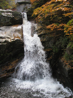
The main trail in the region follows the river and so there are dozens of waterfalls along the way. Fortunately the main attraction is the first waterfall, and so most people just walk to that, take a few pictures, and then head home. That meant that there weren't too many people on the trail past that point.
The leaves have started changing colour in the last week or two, but they still haven't reached their peak yet in this region. However I definitely noticed more colour the higher I climbed.

Sunday, October 10, 2010

Shimanami Kaido - Part 2

As I mentioned in the last post, the bike route has special paths for the sections leading up to the bridges. In the picture above, you can see a lane through a bamboo forest.
On one of the islands I came across this huge brontosaurus(?) on the side of the road. It seemed very out of place, and there was no sign (in English or Japanese) to explain why it was there.
On the second day, I awoke about 5:30 in the morning to a crazy thunderstorm. I'd heard the weather forecast that it was going to rain most of the day, but that didn't make it any easier to get up and get going. It ended up raining off and on all morning until I finished the trip in Imabari around lunch time.
On a nice downhill run after one of the bridges you can see this retired chopper from the Japanese Self-Defense Force (their military).

In Canada, you usually have to go to the beach to see crabs, but in Japan I've seen many crabs quite a ways inland from the ocean. I don't know if they've evolved to not need to go in the water or not, but it's still strange coming across crabs half way up a hill.

Sunday, October 03, 2010

Shimanami Kaido

A week ago we had Chuseok (Korean Thanksgiving) so I ended up with 6 days off. I flew over to Okayama, Japan to see my buddy Trev and his family and a few other friends.
The humidity had finally dropped in Korea a few days before but when I landed in Okayama at 8 at night, I was disappointed to find out that it was still very humid there. Fortunately, it disappeared in the middle of my trip.
I had decided that I wanted to do the Shimanami Kaido, which is a system of 7 or 8 bridges that connect the main Japanese island of Honshu with the 4th largest island of Shikoku, by hopping over several small islands between them.
Apparently when they built it they took bicycles into consideration so it's excellent for biking. Most of the way you follow the regular roads on a dedicated bike lane, but they built special approaches to the bridges for bikes, which although longer, make the climb much more gradual (and manageable).
I rented a bike for about $25 for 2 days in Onomichi in Honshu and hopped the short ferry to the first island to start.
In the first picture above you can see the first bridge.

This is the dedicated bike/walking lane of the first bridge, that is underneath the car lanes. This is really nice because you're not sucking in fumes, however the flip side is that the view is very restricted.
Because it was September and midweek, I saw very few people biking the route. It took me about 10 hours total over 2 days, but I probably only saw about 20 people total biking it. Considering it's one of the more popular bike trips in Japan, I was expecting to see a lot more. I also only saw 2 foreigners.